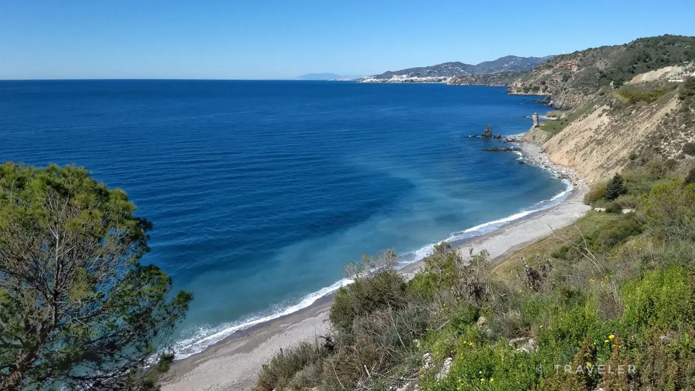
Maro Cliffs: Walk to the Torre de Maro
Trail description
⚠️ Unmarked path near the cliff edge
The path to the Torre de Maro is not waymarked and in places runs close to the edge. Don't leave the path for photos, and hold children's hands on the higher stretches. There is no shade.
The Maro-Cerro Gordo Cliffs are a protected natural area along some 12 km of coast between Nerja and La Herradura, with cliffs up to 250 m above the sea and coves such as Las Alberquillas, El Cañuelo and Cantarriján. There is no continuous path along the clifftops: the best way to see them on foot is the walk from Maro to the Torre de Maro, a 16th-century watchtower above the sea. At the other end, by car, there is the Torre de Cerro Gordo trail.
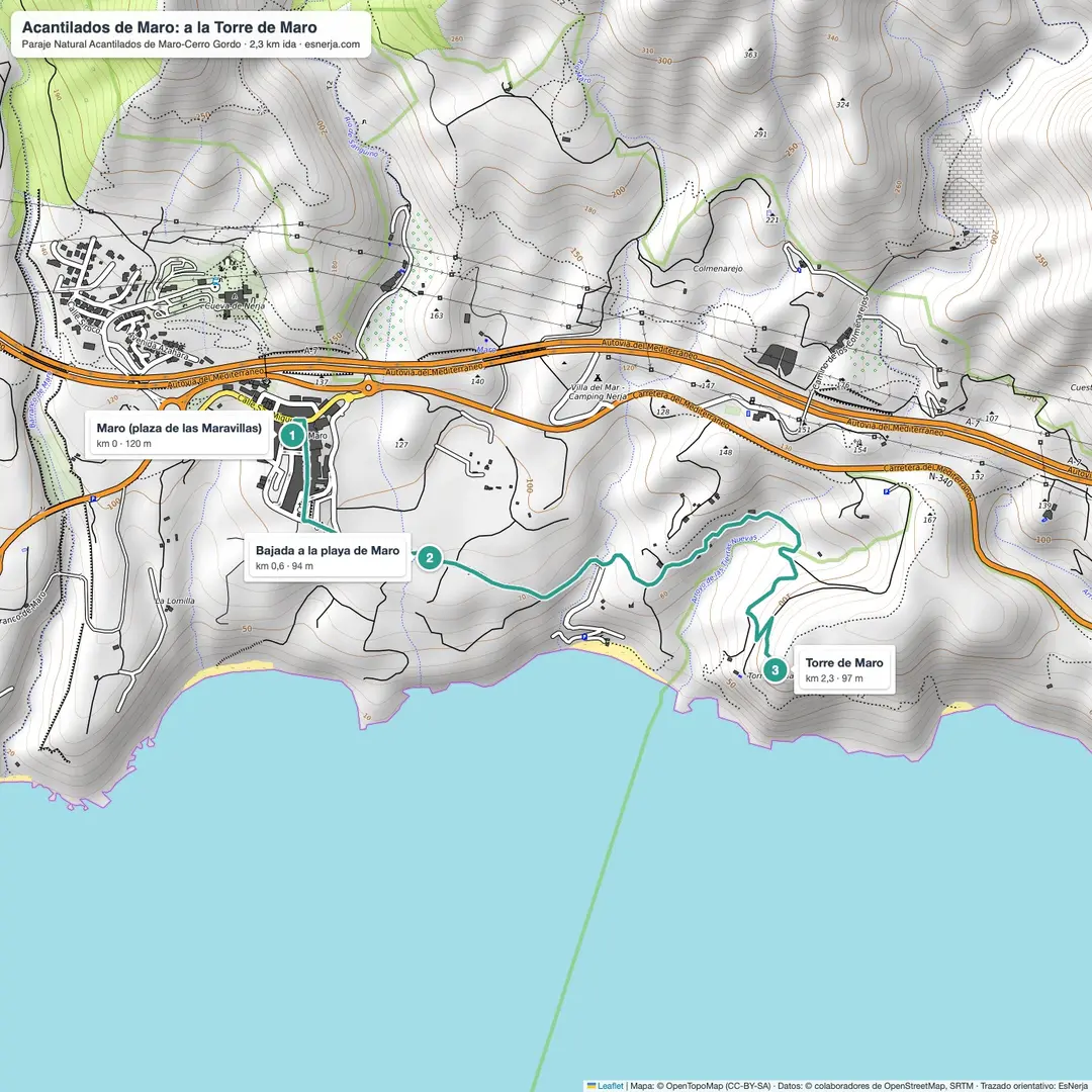
Trail map
Trail facts
- Start: Maro, square by the Maravillas church (120 m).
- Distance: 2.3 km to the tower; 4.6 km there and back.
- Elevation: about 100 m down and up.
- Time: 1.5–2 h there and back with stops.
- Difficulty: easy, on an unmarked path.
- Water and shade: a fountain in Maro; none on the way.
The walk
From Maro's square, walk down through the village towards the beach road. Before reaching the sand, a lane and then a path head east between orchards and scrub to the Torre de Maro, also called Calaturcos: a 16th-century conical watchtower about 11 m high, built to watch the coast. From here you see the cliffs as far as Cerro Gordo and, below, the Alberquillas coves. You return the same way.
The Torre de Cerro Gordo
At the eastern end of the protected area, in Almuñécar, the Junta de Andalucía has a short circular trail from the Cerro Gordo viewpoint car park around the Torre de Cerro Gordo, built in the late 16th century, with views over the bay of La Herradura. It is reached by car on the old N-340, about 15 minutes from Nerja.
Getting there and parking
Maro is 4 km from Nerja; there are buses from Nerja to Maro. By car, the Maro car park by the beach access is free; in summer it fills up early, and the new car park at the western entrance is a good alternative.
Downloads
Sources: Wikipedia (Spanish) "Acantilados de Maro-Cerro Gordo", "Torre de Maro", "Torre de Cerro Gordo"; Junta de Andalucía, Ventana del Visitante (Torre de Cerro Gordo trail); trail line from OpenStreetMap with elevations from Open-Meteo. Checked in October 2026.
📈 Perfil de elevación
Warnings
Recommendations
Points of interest

Maro
Start, by the Maravillas church.
Photo: Dguendel, CC BY 4.0, via Wikimedia Commons

Torre de Maro
16th-century watchtower above the cliff.
Photo: Dguendel, CC BY 4.0, via Wikimedia Commons

The cliffs from Las Alberquillas
The protected coast towards Cerro Gordo.
Photo: Alexander Wagner García, CC BY-SA 3.0 es, via Wikimedia Commons

Torre de Cerro Gordo
Short circular Junta trail, by car from Nerja.
Photo: visamatti, CC BY-SA 2.0, via Wikimedia Commons

Bay of La Herradura
View from Cerro Gordo.
Photo: jlpino, CC BY 3.0, via Wikimedia Commons
Frequently asked questions
Keep exploring
Distance
4.6 km
Time
1h 45min
Elevation +
120 m
Elevation −
120 m
Max alt.
123 m
Min alt.
65 m