Nerja Map
Explore Nerja with our interactive map: find beaches, restaurants, accommodation, activities and all points of interest at a glance. Prefer a printed version? Scroll down to download the free Nerja street map and tourist map in PDF.
Download Nerja Maps
Download these free high-resolution maps of Nerja. Print them or save them on your phone to use offline during your visit.
 View image
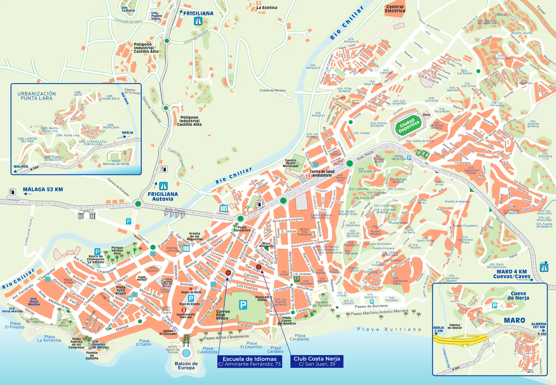
Nerja Street Map
Complete street map with all streets, squares and main points of interest in the town centre of Nerja. Ideal for walking around the village.
Download PDF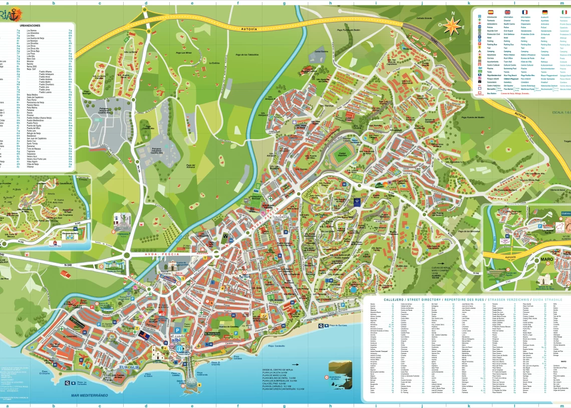 View image
Nerja Tourist Map
General map of Nerja showing the beaches, Balcón de Europa, neighbourhoods and main access points. Perfect for planning your visit.
Download PDFWhere is Nerja?
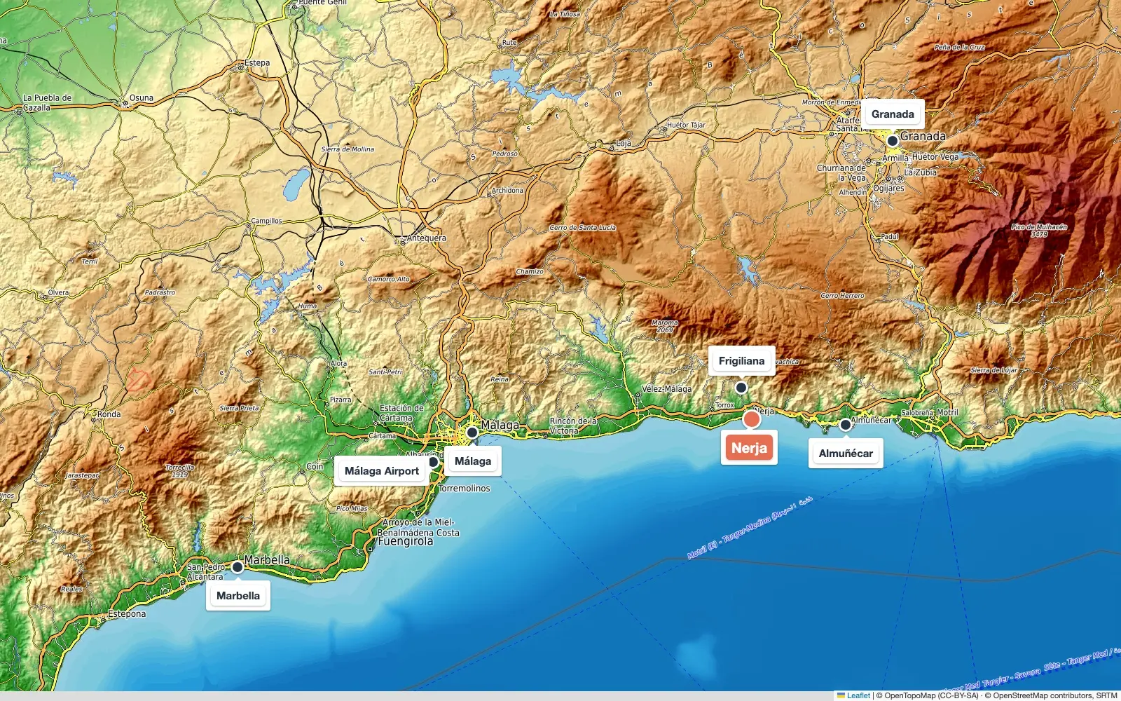
Nerja is on the south coast of Spain, in the province of Málaga (Andalusia), at the eastern end of the Costa del Sol. It sits between the sea and the Sierra de Almijara, about 55 km east of Málaga and 65 km from Málaga Airport along the A-7 motorway.
© OpenTopoMap (CC-BY-SA) · © OpenStreetMap contributors
| To | Distance | By car |
|---|---|---|
| Frigiliana | 7 km | 10 min |
| Almuñécar | 22 km | 20 min |
| Málaga (city centre) | 55 km | 45 min |
| Málaga Airport | 65 km | 50 min |
| Granada | 115 km | 1 h 15 min |
| Marbella | 110 km | 1 h 15 min |
Bus, taxi and transfer options in how to get to Nerja.
Map of Nerja beaches
Nerja's 19 beaches and coves, numbered from west (El Playazo) to east (Cantarriján). The town beaches are around the Balcón de Europa; from Burriana eastwards come the coves of Maro and the cliffs.
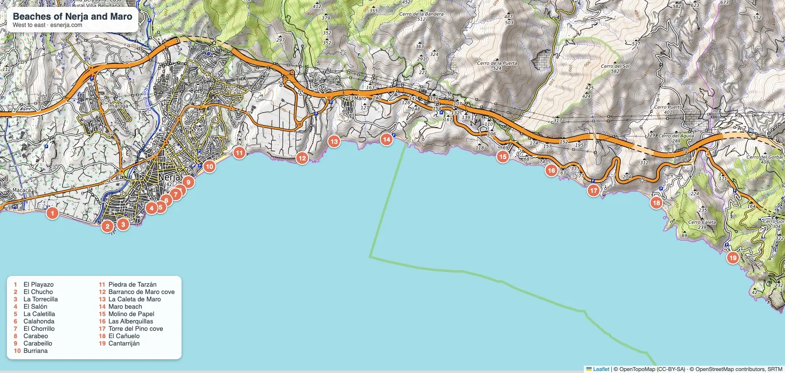
- 1El Playazo Beach
- 2El Chucho Beach
- 3La Torrecilla Beach
- 4El Salón Beach
- 5La Caletilla Beach
- 6Calahonda Beach
- 7El Chorrillo Beach
- 8Carabeo Beach
- 9Carabeillo Beach
- 10Burriana Beach
- 11Piedra de Tarzán Cove
- 12Barranco de Maro Cove
- 13La Caleta de Maro Beach
- 14Maro Beach
- 15Molino de Papel Beach
- 16Las Alberquillas Beach
- 17Torre del Pino Cove
- 18El Cañuelo Beach
- 19Cantarriján Nudist Beach
Compare all Nerja beaches: type, parking, lifeguards and beach bars.
Nerja Street Map
The Nerja street map shows the streets and main locations of the town, situated in the province of M\u00e1laga. It is a very useful tool for both residents and tourists visiting Nerja, as it helps you navigate the town and easily find the places you are looking for. Streets are labelled with their names and the main tourist attractions, monuments, squares and parks are marked on the map.
How to Use the Interactive Map
On the interactive map above you can filter by category (beaches, restaurants, accommodation, things to do, activities and festivals) using the Filter button. Click on any marker to see a quick info card with a photo, address and a link to all the details. This way you can plan your route around Nerja and discover what is near your accommodation or your chosen beach.