Río Higuerón Walk from Frigiliana
Trail description
🌊 The river changes with the rain
Depending on the season the river carries little or quite a lot of water; after heavy rain it may be impassable. Don't go in if storms are forecast and check the depth before getting into a pool. Part of the lower riverbed, between Frigiliana and the Chíllar, crosses private farms and a hunting estate (“Private property” signs): this route goes upstream.
The Higuerón river comes down from the Sierra de Almijara, near Cerro Lucero, and passes below Frigiliana before joining the Chíllar. Its narrow bed, between rock walls, pine woods and oleanders, can be walked from the village: you go down the Cuesta del Apero to the Pozo Batán and follow the river upstream, through fords and pools, to the Lízar weir, the small dam where the Lízar irrigation channel starts.
📥 Take the route on your phone (there may be no coverage in the riverbed):
Map and guide (PDF)GPX trackTrail map
Trail facts
- Start: Frigiliana, Calle San Sebastián (320 m).
- Distance: 5.4 km to the Lízar weir; 10.7 km there and back.
- Elevation: about 300 m of total ascent (the river climbs gently).
- Time: 3.5–4 h there and back with stops.
- Difficulty: moderate: stony riverbed, fords and some rocky steps.
- Water: the river water is not drinkable; bring your own.
The route, section by section
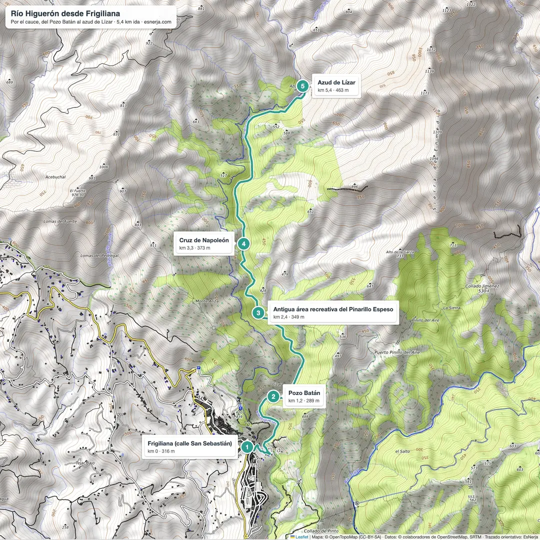
Frigiliana – Pozo Batán (km 0–1.2). From Calle San Sebastián, walk down the Cuesta del Apero and the Camino del Boticario to the riverbed and the Pozo Batán, an old irrigation work.
Pozo Batán – Cruz de Napoleón (km 1.2–3.3). Upstream, the way alternates between the riverbed and paths on the banks. You pass the ruins of the old Pinarillo Espeso picnic area (km 2.4) and the Cruz de Napoleón (km 3.3), where the river runs between rock walls: the Higuerón gorges.
Cruz de Napoleón – Lízar weir (km 3.3–5.4). The valley opens out among pines up to the Lízar weir. You return the same way; you can also come back along the Lízar channel path, high above the river, narrower and with drops in places.
Getting there and parking
Frigiliana is 7 km from Nerja; there are buses between the two. By car, at the entrance to the village there is a paid underground municipal car park and a few free surface spaces that fill up early.
Downloads
Sources: Wikipedia (Spanish), "Río Higuerón" (12.7 km, gorges, channels and dam); Frigiliana Tourism; trail line from OpenStreetMap with elevations from Open-Meteo. Checked in October 2026.
📈 Perfil de elevación
Warnings
Recommendations
Points of interest

Frigiliana
Start of the route, in the old town.
Photo: EsNerja

Higuerón river
The river as it passes Frigiliana; by the riverbed, the Pozo Batán, an old irrigation work.
Photo: Millars, CC BY-SA 4.0, via Wikimedia Commons
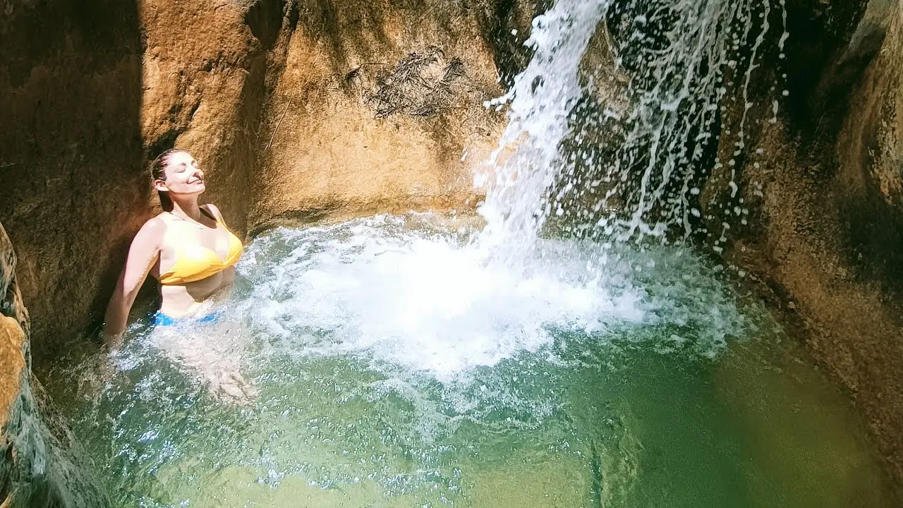
Higuerón pools and gorges
Pools and small falls between rock walls, upstream of the Cruz de Napoleón.
Photo: EsNerja
Lízar weir
Small dam where the Lízar channel starts (km 5.4).
Frequently asked questions
Keep exploring
Distance
10.7 km
Time
3h 45min
Elevation +
300 m
Elevation −
300 m
Max alt.
483 m
Min alt.
258 m