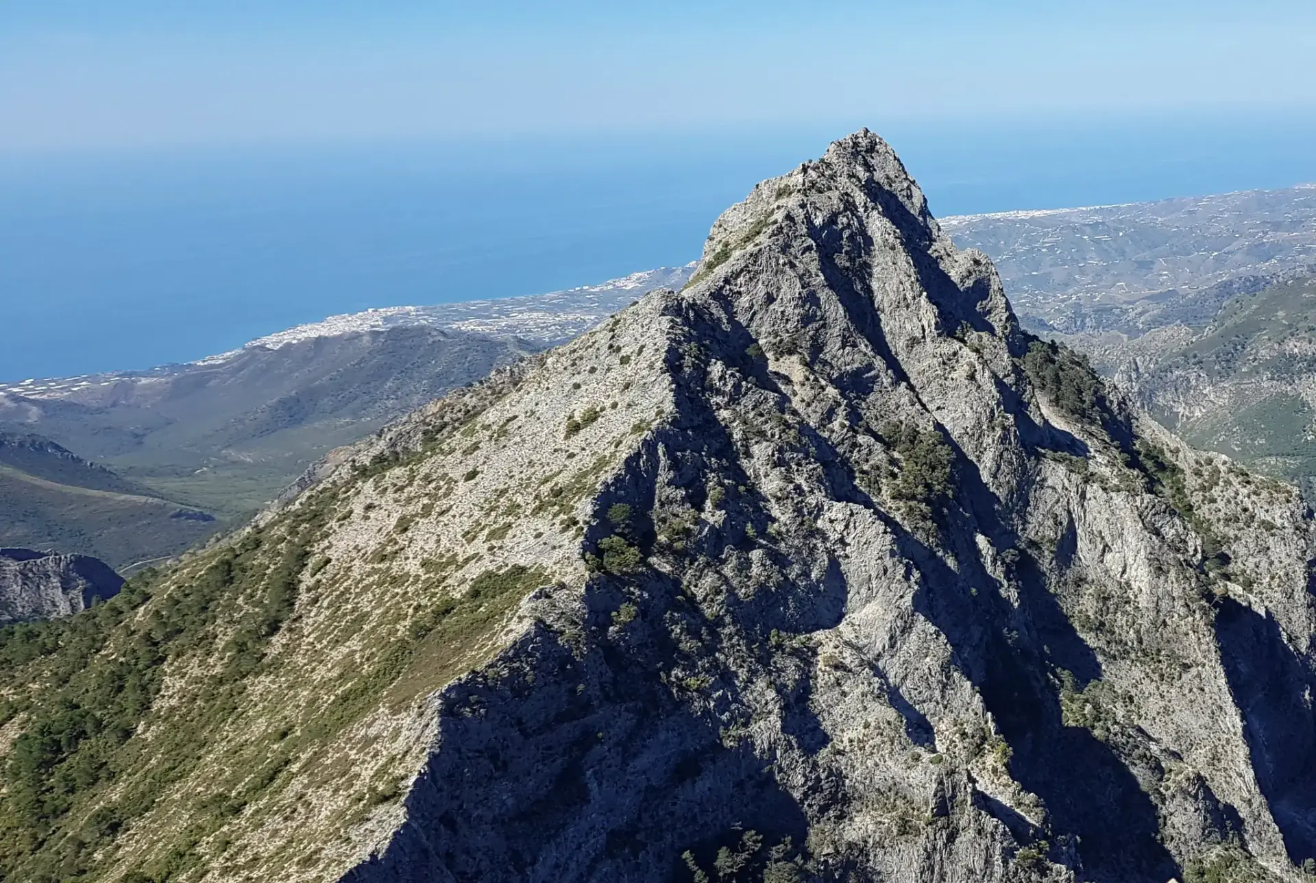
El Almendrón Hike from the Fuente del Esparto
Trail description
⛰️ A demanding mountain route
From the Fuente del Esparto it is 5.6 km one way and about 940 m of climbing on a steep path, with the last stretch over rock and no water beyond the spring. If the Pinarillo track is closed to cars, add 11.5 km there and back from the Nerja Caves.
El Almendrón (1,514 m) is the pyramid of dolomite rock that towers over El Pinarillo and the Fuente del Esparto. The climb follows the old Vereda de las Minas, the path used to bring lead down from the La Furia mines, and ends on a summit with views of the sea, Pico del Cielo, Navachica and La Maroma.
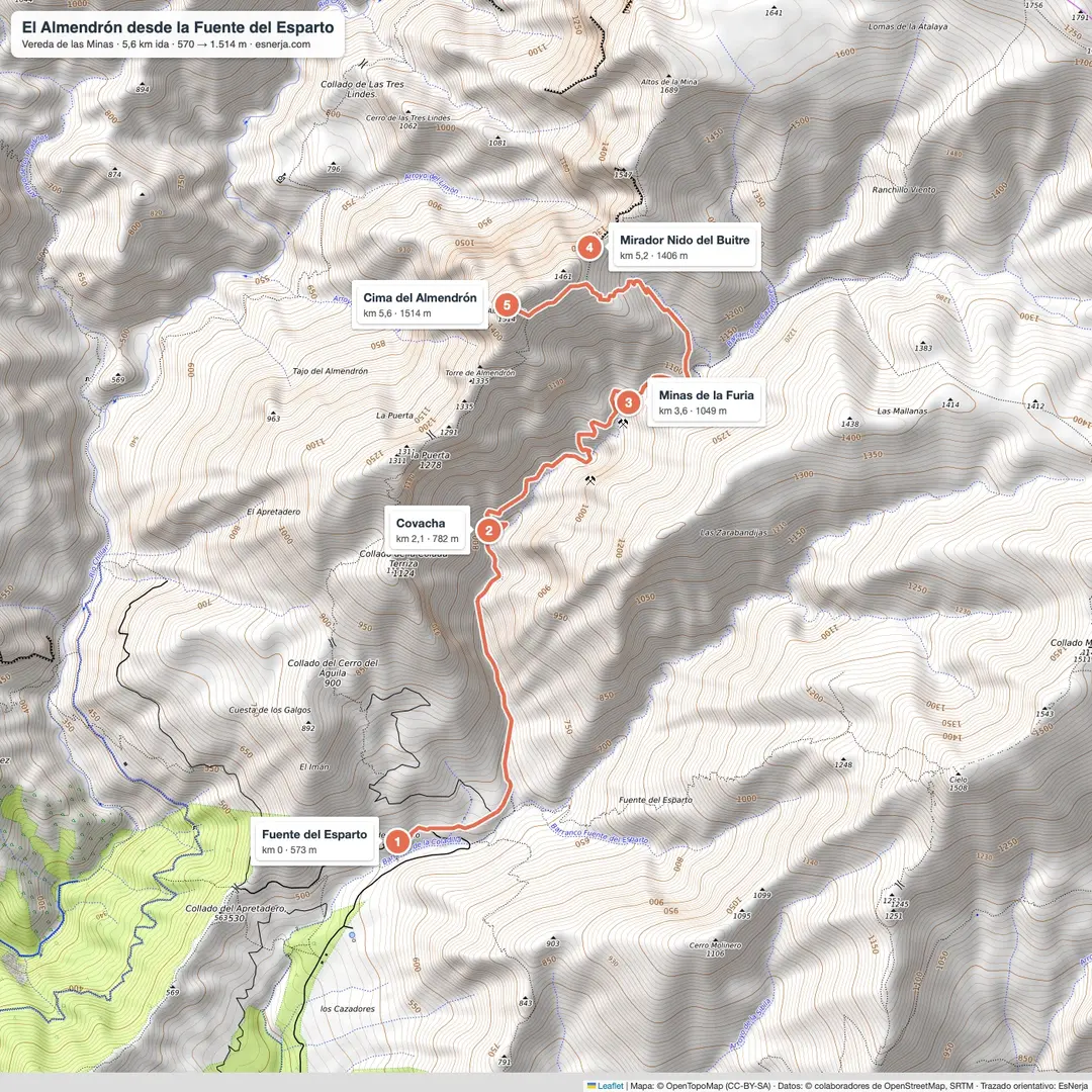
Trail map
Trail facts
- Start: Fuente del Esparto spring (570 m), 5.8 km from the Nerja Caves along the Pinarillo track.
- Distance: 5.6 km from the spring to the summit; 11.3 km there and back (about 23 km from the caves).
- Elevation: 940 m from the spring to the summit; about 1,100 m of total ascent.
- Time: 5–6 h there and back from the spring.
- Difficulty: hard: steep path, final stretch over rock without a clear path.
- Water: only at the Fuente del Esparto (and at El Pinarillo if you start at the caves).
The climb, section by section
Fuente del Esparto – La Furia mines (km 0–3.6). From the spring, by the old miners' houses, the path climbs north along the Vereda de las Minas y Cómpeta, passes a rock shelter (km 2.1) and reaches the entrances of the Tajo and La Furia mines, where galena was extracted.
Mines – Nido del Buitre pass (km 3.6–5.2). About a kilometre past the mines, by a large pine, a path branches left and zigzags up a ridge to a pass on the north face of El Almendrón, with views of the Chíllar valley and the Imán farmhouse.
Pass – summit (km 5.2–5.6). The final stretch climbs over rock to the top. There is not always a clear path: if you don't feel sure, the pass is already a great viewpoint. You return the same way.
Getting to the Fuente del Esparto
From the Nerja Caves car park (paid) along the Pinarillo track: 5.8 km, see the Fuente del Esparto walk. The track has a barrier by the caves that is usually closed to cars in summer and whenever there is a fire risk, and open in the cooler months depending on the rain; when it is open, you can drive up and park without blocking the track.
Downloads
Sources: Diputación de Málaga route description (Visita Nerja); trail line of the Vereda de las Minas from OpenStreetMap with elevations from Open-Meteo; mountaineers' accounts. Checked in October 2026.
📈 Perfil de elevación
Warnings
Recommendations
Points of interest
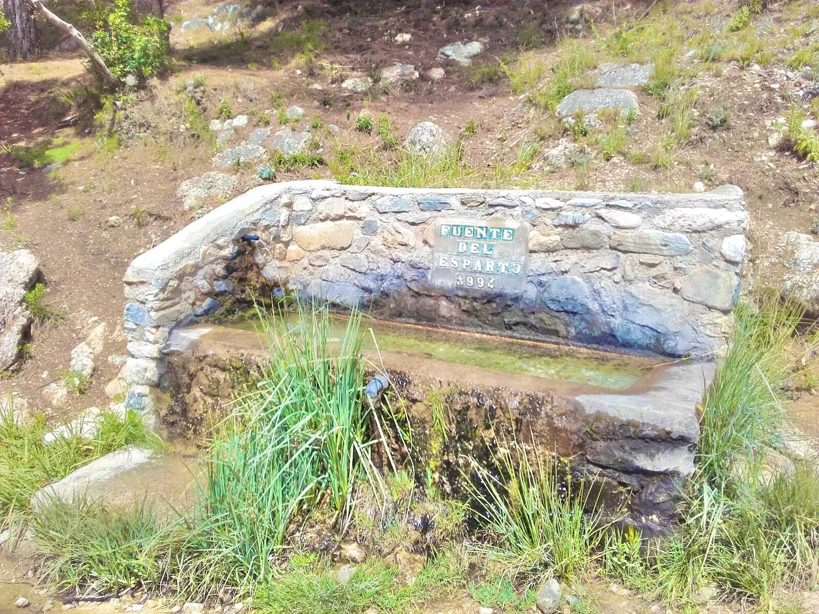
Fuente del Esparto
Start and last water, by the miners' houses.
Photo: EsNerja

The sierra above El Pinarillo
The Almijara on the way to the spring.
Photo: Alexander Wagner García, CC BY-SA 3.0 es, via Wikimedia Commons
La Furia mines
Old galena (lead) mines. Do not enter the shafts.
El Almendrón
A 1,514 m pyramid of dolomite rock.
Photo: EsNerja
Frequently asked questions
Keep exploring
Distance
11.3 km
Time
5h 30min
Elevation +
1100 m
Elevation −
1100 m
Max alt.
1514 m
Min alt.
552 m