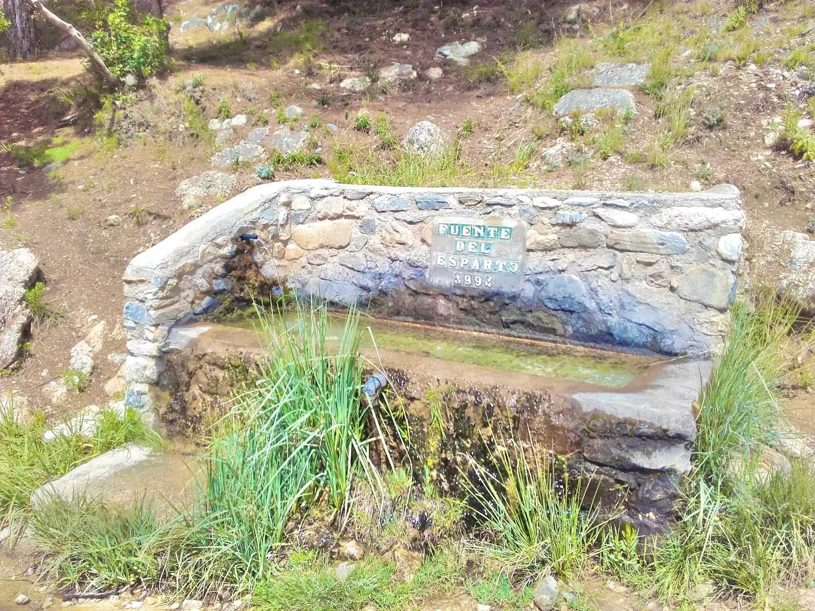
Fuente del Esparto Walk from the Nerja Caves
Trail description
🚧 Track access
The Pinarillo track has a barrier by the Nerja Caves that is usually closed to cars in summer and whenever there is a fire risk, and open in the cooler months depending on the rain. Plan to walk the route from the caves car park.
The Fuente del Esparto is a spring in the Sierra de Almijara, next to the old miners' houses, where the lead ore brought down from the La Furia mines was washed. From the Nerja Caves you reach it along the Pinarillo forest track, which follows the Gran Senda de Málaga (GR 249) through pines with the sea behind you: a mountain walk with no technical difficulty, and water and shade at the end. It is also the starting point for the routes up El Almendrón, Navachica and down to the Chíllar river.
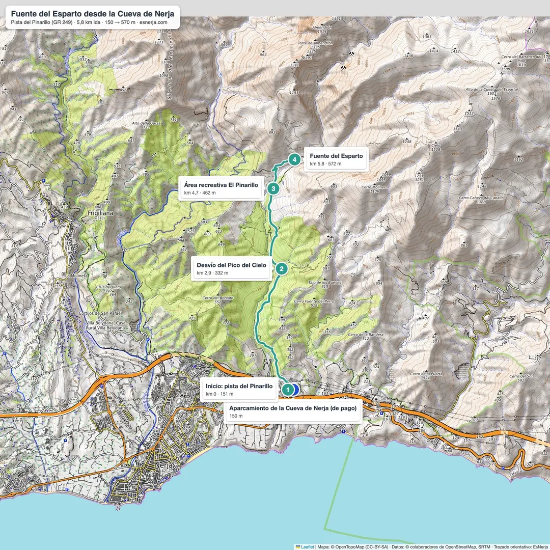
Trail map
Trail facts
- Start: Nerja Caves car park (150 m).
- Distance: 5.8 km to the spring; 11.5 km there and back on the same track.
- Elevation: 420 m from the caves to the spring; about 600 m of total ascent there and back.
- Time: 2 h up and 1.5 h down; 3.5–4 h with stops.
- Difficulty: moderate: wide gravel track with a steady climb, no difficult sections.
- Water: a fountain at the El Pinarillo picnic area (km 4.7) and the Fuente del Esparto itself.
- Waymarking: Gran Senda de Málaga (GR 249, white and red marks).
The route, section by section
Nerja Caves – Pico del Cielo turn-off (km 0–2.9). The track climbs gently up the valley through Aleppo pines and Mediterranean scrub. At km 2.9 the Pico del Cielo path branches off to the right; stay on the track.
Turn-off – El Pinarillo (km 2.9–4.7). The track gains height with ever wider sea views. You reach the El Pinarillo picnic area: tables in the shade of the pines and a fountain.
El Pinarillo – Fuente del Esparto (km 4.7–5.8). One more kilometre of track takes you to the spring, by the ruins of the miners' houses. This is where the Junta's waymarked path down to the Chíllar river starts (4.5 km one way, via the Cuesta de los Galgos): check the access status of the river before heading down.
Getting there and parking
The Nerja Caves are 4 km from the town centre on the Maro road; buses from Nerja to Maro stop by the caves. The caves car park is paid and attended during the caves' opening hours. When the track barrier is open some people drive up to El Pinarillo or the spring, but hikers and cyclists use the track: when it is closed, it is not an option.
Downloads
- Fuente del Esparto map and guide (PDF).
- GPX track of the route, for Wikiloc, Komoot or any other app.
Sources: "El Pinarillo – Fuente del Esparto – Río Chíllar" trail sheet (Junta de Andalucía, Ventana del Visitante); Nerja town council notices on vehicle access to El Pinarillo; trail line from OpenStreetMap with elevations from Open-Meteo. Checked in October 2026.
📈 Perfil de elevación
Warnings
Recommendations
Points of interest

Nerja Caves car park
Start of the route (paid).
Photo: EsNerja

The Pinarillo track
Gravel track through pines (GR 249).
Photo: Alexander Wagner García, CC BY-SA 3.0 es, via Wikimedia Commons
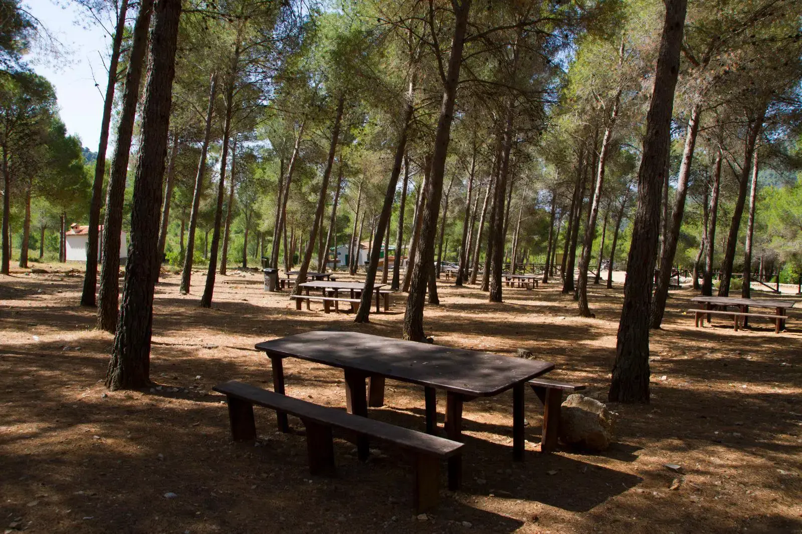
El Pinarillo picnic area
Tables, shade and a fountain (km 4.7).
Photo: EsNerja

Sea view
The coast between the hills, by El Pinarillo.
Photo: Alexander Wagner García, CC BY-SA 3.0 es, via Wikimedia Commons
Fuente del Esparto
Spring by the miners' houses (km 5.8).
Photo: EsNerja
Frequently asked questions
Keep exploring
Distance
11.5 km
Time
3h 45min
Elevation +
600 m
Elevation −
600 m
Max alt.
572 m
Min alt.
150 m