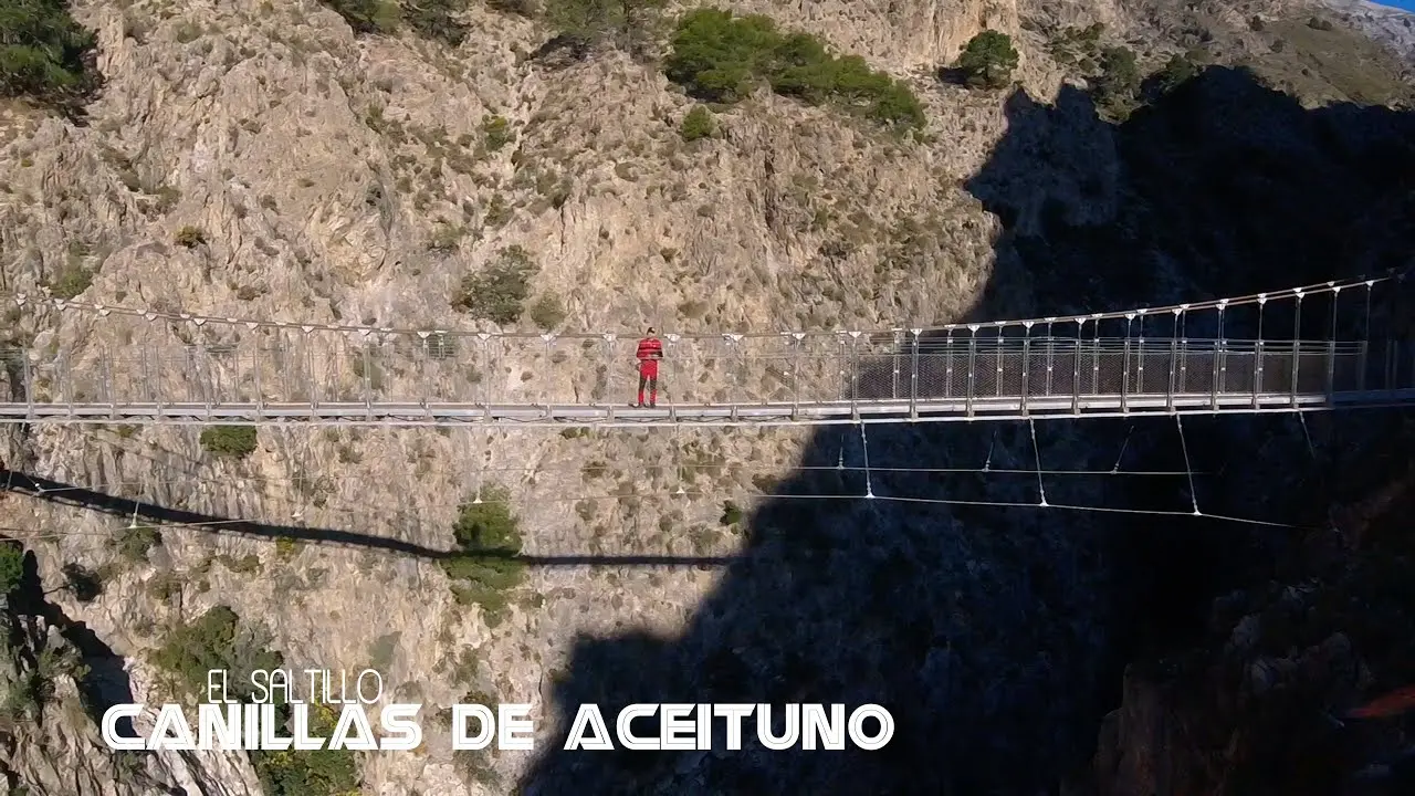
El Saltillo Suspension Bridge from Canillas de Aceituno
Trail description
🌉 Exposed path and a swaying bridge
The path is narrow, with stretches above the ravine, steps and a very steep descent to the bridge. The suspension bridge sways: if you suffer from vertigo, think twice. There is no water on the way.
El Saltillo is the suspension bridge walk from Canillas de Aceituno: a walkway about 50 m long strung across the gorge of the Almanchares river, between Canillas de Aceituno and Sedella. From the village you reach it along a mountain path cut into the hillside, with crags, handrails and views of La Maroma. The bridge is part of the Gran Senda de Málaga and access is free.
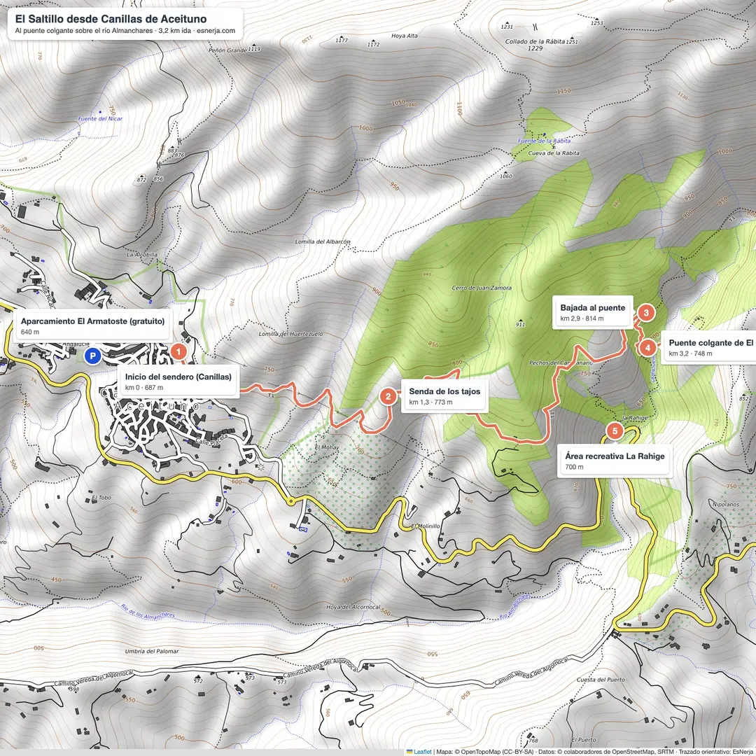
Trail map
Trail facts
- Start: top of Canillas de Aceituno village (690 m).
- Distance: 3.2 km to the bridge; 6.4 km there and back.
- Elevation: about 300 m of total ascent there and back.
- Time: 3 h there and back with stops.
- Difficulty: moderate: narrow path with exposed stretches and steps.
- Water: no fountains on the way.
- Price: free.
The route, section by section
Canillas – crag path (km 0–1.3). The trail leaves the top of the village, next to the start of the La Maroma path, and heads east, climbing above the Almanchares valley.
Crag path – descent to the bridge (km 1.3–2.9). The path runs across the hillside, with narrow stretches, steps and handrails, and views of the ravine and La Maroma. It reaches its highest point at about 820 m.
Descent – suspension bridge (km 2.9–3.2). A very steep descent leads to the El Saltillo suspension bridge. On the other side, a short path climbs to the La Rahige picnic area, and upstream are the El Saltillo pools and waterfall. You return the same way.
Getting there and parking
Canillas de Aceituno is 42 km from Nerja, about 50 minutes: A-7 and, after Vélez-Málaga, the A-356 towards La Viñuela. Park in the "El Armatoste" municipal car park on Avenida de Andalucía: it is free and covered, though the ramps between levels are narrow. From there, walk up through the village. Another option is to start at the La Rahige picnic area, which has parking, on the other side of the bridge.
Combine it with La Maroma
El Saltillo and the climb up La Maroma start from the same point in Canillas. They are two different routes: La Maroma is a full high-mountain day.
Downloads
Sources: OpenStreetMap trail line (El Saltillo path and suspension bridge) with elevations from Open-Meteo; Costa del Sol Tourism (bridge of about 50 m over the Almanchares on the Gran Senda de Málaga, free access); aparcamientoespana.com (El Armatoste). Checked in October 2026.
📈 Perfil de elevación
Warnings
Recommendations
Points of interest

Canillas de Aceituno
Start and finish: bars and restaurants on the square.
Photo: Rufus46, CC BY-SA 3.0, via Wikimedia Commons

Path with handrail
Stretches across the hillside above the Almanchares valley.
Photo: Juan Pablo Olmo, CC BY 2.0, via Wikimedia Commons

The Almanchares ravine
Rock walls by the bridge.
Photo: Juan Pablo Olmo, CC BY 2.0, via Wikimedia Commons
El Saltillo suspension bridge
About 50 m across the Almanchares river.
Photo: EsNerja
La Rahige picnic area
Across the bridge, with parking.
Frequently asked questions
Keep exploring
Distance
6.4 km
Time
3h
Elevation +
300 m
Elevation −
300 m
Max alt.
822 m
Min alt.
684 m