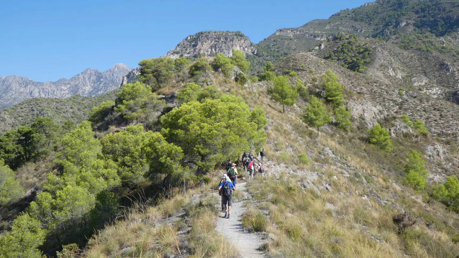
Walking from Nerja to Frigiliana
Trail description
🥾 A hill walk, not a flat stroll
It is 7.6 km with about 700 m of total ascent: the path climbs and drops over the hills between the Chíllar and the Higuerón, with no shade or water until Frigiliana. Return by bus.
You can walk from Nerja to Frigiliana on hill paths without setting foot on the road: from the north of Nerja, by the Chíllar river, to the Cruz del Pinto, the Lomas del Chíllar viewpoint (459 m) and the Pozo Batán by the Higuerón river, entering Frigiliana up the Cuesta del Apero. These are paths waymarked by Frigiliana, with sea views most of the way. There is a bus back to Nerja.
Trail map
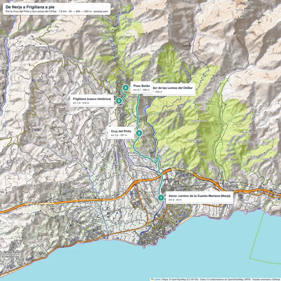
Trail facts
- Start: Camino de la Cuesta Mariana, in the north of Nerja (50 m), about 20 minutes' walk from the Balcón de Europa.
- Finish: Frigiliana old town (320 m).
- Distance: 7.6 km, one way.
- Elevation: about 700 m of total ascent and 430 m of descent.
- Time: 3–3.5 h with stops.
- Difficulty: moderate: hill path with steep climbs and loose stones.
- Water: no fountains until Frigiliana.
- Return: Frigiliana–Nerja bus, or the same way back.
The route, section by section
Nerja – Cruz del Pinto (km 0–3.8). From the Camino de la Cuesta Mariana, by the Chíllar riverbed, a lane and then a track climb west between avocado and mango orchards. The path reaches the ridge and the Cruz del Pinto, the first viewpoint over Nerja.
Cruz del Pinto – Lomas del Chíllar (km 3.8–5.7). You drop to the Pinto pass and climb to the top of the Lomas del Chíllar, the highest point of the route: Nerja, the Chíllar valley and the Sierra de Almijara.
Lomas del Chíllar – Frigiliana (km 5.7–7.6). Down to the Higuerón river and the Pozo Batán, an old irrigation work, then up into Frigiliana via the Camino del Boticario and the Cuesta del Apero.
Why not along the river
Some people walk the lower bed of the Higuerón river, but part of that stretch crosses private farms and a hunting estate, with “Private property” signs. This route keeps to the hills on public, waymarked paths. If you want to walk in the river, the Río Higuerón route heads upstream from Frigiliana.
Getting there and back
The start is about 20 minutes' walk from central Nerja. By car, the free Calle Mirto car park is about 10 minutes away. To return, there are buses from Frigiliana to Nerja throughout the day (Grupo Verano Azul line; check the Frigiliana town council timetable).
Downloads
Sources: OpenStreetMap trail line (Cruz del Pinto and Lomas del Chíllar paths) with elevations from Open-Meteo; Frigiliana Tourism "Frigiliana – Lomas del Chíllar" route sheet; Frigiliana town council bus timetable. Checked in October 2026.
📈 Perfil de elevación
Warnings
Recommendations
Points of interest
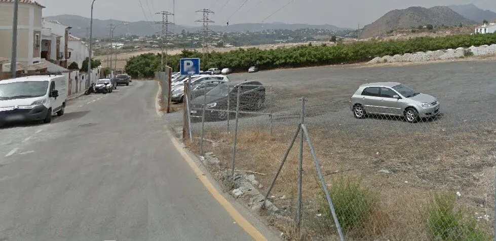
Calle Mirto car park
Free, unpaved, about 10 minutes from the start.
Photo: EsNerja
Cruz del Pinto
The first big viewpoint over Nerja (km 3.8).
Lomas del Chíllar viewpoint
Highest point of the route, 459 m (km 5.7).

Higuerón river
The river as it passes Frigiliana; by the riverbed, the Pozo Batán, an old irrigation work.
Photo: Millars, CC BY-SA 4.0, via Wikimedia Commons
Frigiliana
Moorish old town, end of the route.
Photo: EsNerja
Frequently asked questions
Keep exploring
Distance
7.6 km
Time
3h 15min
Elevation +
700 m
Elevation −
430 m
Max alt.
459 m
Min alt.
48 m