Pico del Cielo Hike from the Nerja Caves
Trail description
⛰️ Long, steep and dry
It is 9.8 km one way from the Nerja Caves with 1,360 m of climbing to the summit, with no water at all on the route and hardly any shade from halfway up. The summit is often in cloud even when the coast is sunny.
Pico del Cielo (1,508 m) is Nerja's mountain: the pyramid you see above the Sierra de Almijara from the Balcón de Europa. It is not the highest summit in the Sierras de Tejeda, Almijara y Alhama Natural Park, but it is the most iconic in the municipality, for its shape and its views: the whole coast at your feet and, on the clearest days, the mountains of Africa. The way up is the waymarked PR-A 477 trail, which starts at the Nerja Caves and climbs the Cuesta del Cielo.
The Pico del Cielo trail holds the Blue Trail (Sendero Azul) award from ADEAC, the association behind the Blue Flags, renewed in 2025: Nerja is the only municipality in the province with two Blue Trails, this one and the Nerja Cave–Almijara trail. In April 2026 the town council organised the first Blue Trail hike to the summit.
Trail map
Trail facts
- Start: Nerja Caves car park (150 m), 4 km from the town centre.
- Distance: 9.8 km to the summit; 19.6 km there and back. If the track is open and you drive to the start of the Cuesta del Cielo, about 14 km there and back.
- Elevation: 1,360 m from the caves to the summit; about 1,500 m of total ascent.
- Time: 4–4.5 h up and 3 h down; 7–8 h with stops.
- Difficulty: hard because of length and gradient; no scrambling.
- Waymarking: white and yellow PR-A 477 marks (the first 2.9 km also follow the GR 249 Gran Senda).
- Water: no springs at all on the route.
- Best time: October to May. In summer, only with a dawn start.
The climb, section by section
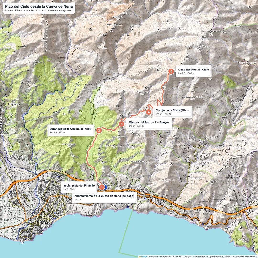
Nerja Caves – Cuesta del Cielo (km 0–2.9). You follow the forest track towards El Pinarillo, through pines and Mediterranean scrub, together with the Gran Senda de Málaga. A gentle warm-up.
Cuesta del Cielo – Civila farmhouse (km 2.9–6.1). Leaving the track, the real climb begins, first through the pine wood. At km 4 is the Tajo de los Bueyes viewpoint, looking over the Nerja and Maro coast. You reach the ruined Civila (or Sibila) farmhouse on a pass at about 780 m.
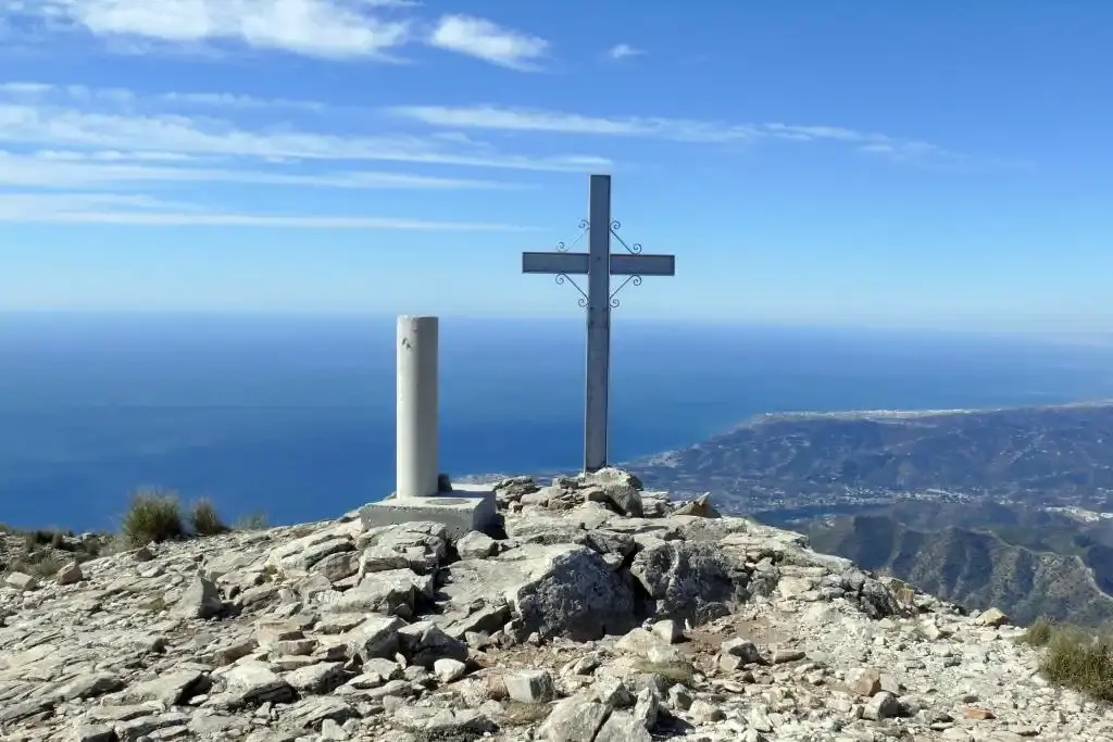
Civila farmhouse – summit (km 6.1–9.8). The gradient increases, the pines disappear and the path climbs relentlessly up the open slope of the Cuesta del Cielo. The last stretch is stony. At the top are the trig point and a cross, and one of the best views in the Axarquía: the coast from Málaga to Almuñécar, the Almijara, La Maroma and, to the north, Sierra Nevada.
You return the same way. The descent is long and hard on the knees.
Getting there and parking
The route starts at the Nerja Caves car park, which is paid and attended during the caves' opening hours; in high season it fills up early. Buses from Nerja to Maro stop by the caves.
The Pinarillo track has a barrier by the caves that is usually closed to cars in summer and whenever there is a fire risk, and open in the cooler months depending on the rain. When it is open, many people drive up to the start of the Cuesta del Cielo (km 2.9) and park on the edge of the track without blocking it; when it is closed, you start walking from the caves.
More routes from here
From the same start, the track leads to the El Pinarillo picnic area and the Fuente del Esparto spring, both much easier. From the summit of El Cielo, the ridge continues to Navachica (1,832 m), the highest point of the Almijara: for experienced mountain walkers only.
Downloads
- Pico del Cielo map and guide (PDF): full-page map, the climb section by section and safety tips.
- GPX track of the climb, for Wikiloc, Komoot, Google Earth or any other app.
Sources: official PR-A 477 "Pico del Cielo" trail sheet (Junta de Andalucía, Nerja trail network); trail line from OpenStreetMap (elevations from Open-Meteo); Nerja town council notices on vehicle access to El Pinarillo. Checked in October 2026.
📈 Perfil de elevación
Warnings
Recommendations
Points of interest
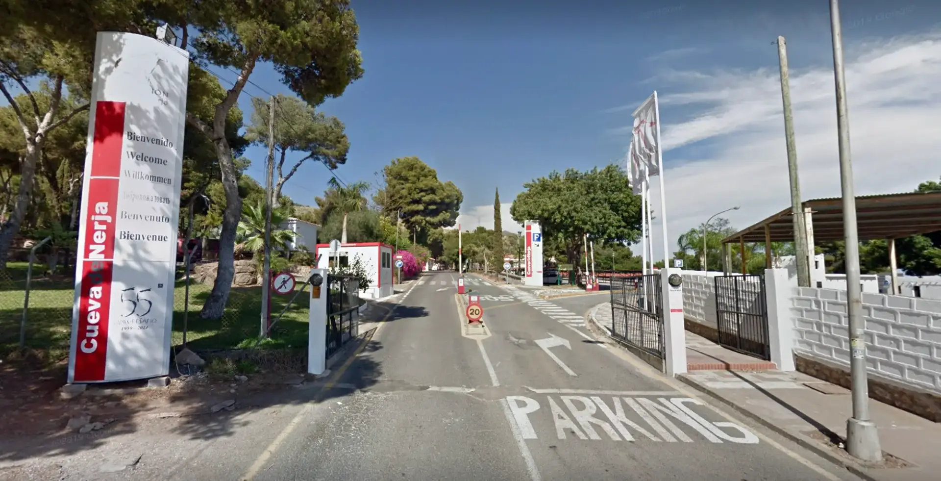
Nerja Caves car park
Start of the route. Paid and attended during the caves' opening hours.
Photo: EsNerja

Pinarillo track (GR 249)
The first 2.9 km, on a forest track through pines.
Photo: Alexander Wagner García, CC BY-SA 3.0 es, via Wikimedia Commons

Cuesta del Cielo pine wood
Climbing through pines with the Almijara behind (km 4).
Photo: Juan Pablo Olmo, CC BY 2.0, via Wikimedia Commons

Summit cross and trig point
The Pico del Cielo cross at 1,508 m, with the coast behind.
Photo: Juan Pablo Olmo, CC BY 2.0, via Wikimedia Commons

Views from the top
The Axarquía, the coast and the sierras from the summit.
Photo: Juan Pablo Olmo, CC BY 2.0, via Wikimedia Commons
Frequently asked questions
Keep exploring
Distance
19.6 km
Time
7h 30min
Elevation +
1500 m
Elevation −
1500 m
Max alt.
1508 m
Min alt.
150 m