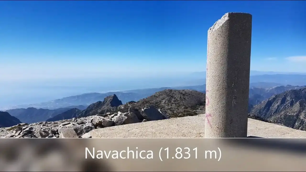
Navachica Hike from the Fuente del Esparto
Trail description
⚠️ High mountain, experienced walkers only
It is 10.5 km one way from the Fuente del Esparto and about 1,900 m of total ascent there and back, with poorly marked stretches, scree and a long ridge exposed to fog and wind. There is no water after the spring. In bad weather or without mountain experience, don't do it.
Navachica (1,832 m) is the highest peak in the Sierra de Almijara and lies within the municipality of Nerja. The most direct route from the coast climbs the Barranco de los Cazadores to Pico del Cielo and follows the ridge of the sierra north, over white dolomite rock and sand, to the Navachica trig point. From the summit you see La Maroma, El Lucero, Sierra Nevada and the sea.
📥 Take the route on your phone: it is easy to get lost on the ridge in fog.
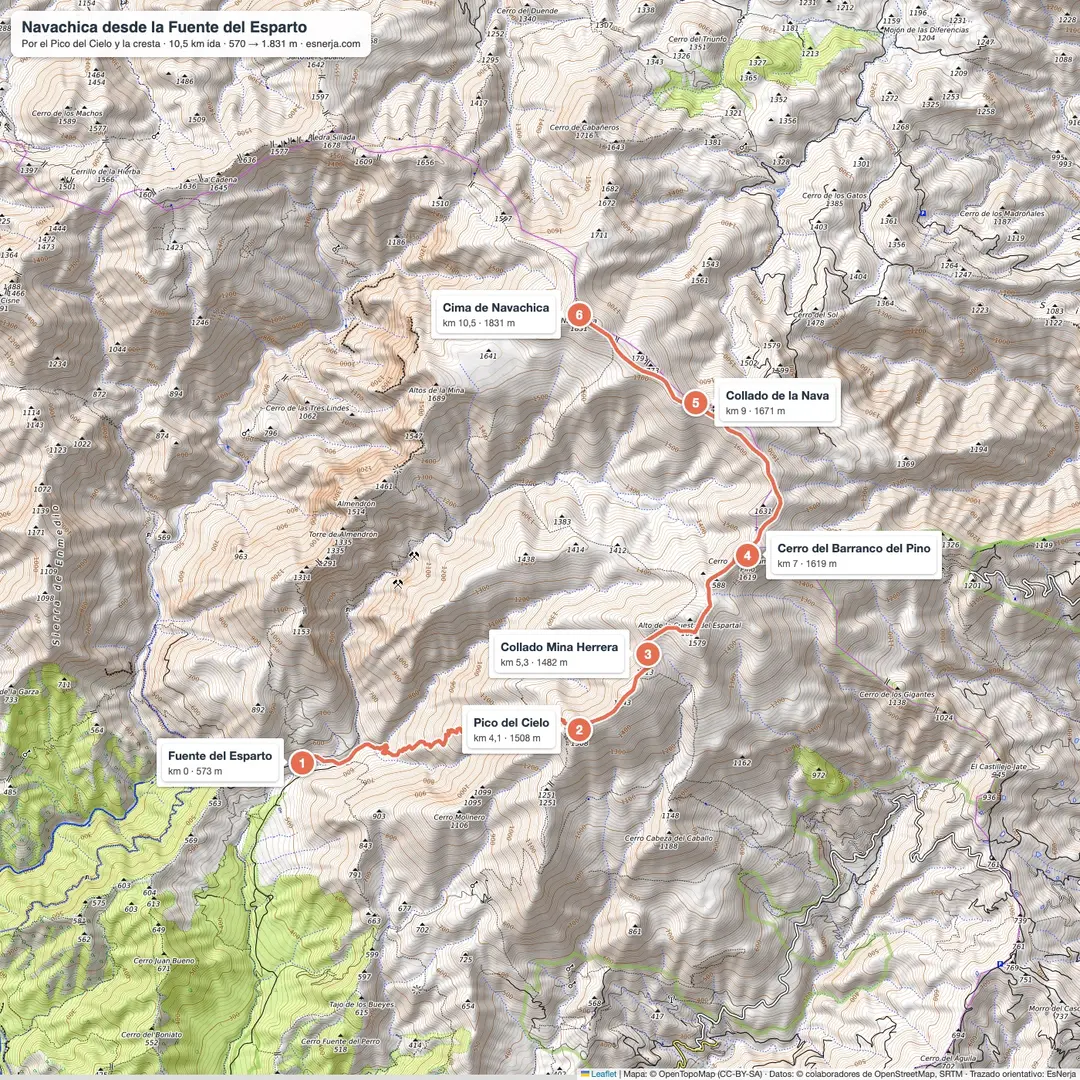
Map and guide (PDF)GPX trackTrail map
Trail facts
- Start: Fuente del Esparto spring (570 m), 5.8 km from the Nerja Caves along the Pinarillo track.
- Distance: 10.5 km one way; 21 km there and back from the spring (about 32 km from the caves).
- Elevation: 1,260 m from the spring to the summit; about 1,900 m of total ascent there and back, as the ridge goes up and down.
- Time: 9–10 h there and back from the spring.
- Difficulty: very hard: high-mountain path with unmarked stretches.
- Water: only at the Fuente del Esparto, at the start.
The route, section by section
Fuente del Esparto – Pico del Cielo (km 0–4.1). You enter the stony bed of the Barranco de los Cazadores, leave it up a scree slope, and a steep path takes you to the ridge and the cross on Pico del Cielo (1,508 m).
Pico del Cielo – Collado de la Nava (km 4.1–9). The ridge continues north over the Mina Herrera pass, the Alto de la Cuesta del Espartal, the Cerro del Barranco del Pino (1,619 m) and the Puerto de la Orza. Some stretches have a clear path; on others you follow cairns and the track.
Collado de la Nava – Navachica (km 9–10.5). The final climb up the summit ridge leads to the trig point. You return the same way: keep energy and daylight for it.
Getting to the Fuente del Esparto
From the Nerja Caves car park (paid) along the Pinarillo track: 5.8 km, see the Fuente del Esparto walk. The track has a barrier that is usually closed to cars in summer and whenever there is a fire risk, and open in the cooler months depending on the rain: if it is closed, the day becomes more than 30 km.
Shorter alternatives
Climbing just Pico del Cielo on the PR-A 477, or El Almendrón from the Fuente del Esparto, is already a big mountain day with less commitment.
Downloads
Sources: Wikipedia ("Navachica": 1,832 m, highest peak of the Sierra de Almijara, municipality of Nerja); OpenStreetMap trail line and difficulty grading with elevations from Open-Meteo; mountaineers' accounts (Picobarro, 2025). Checked in October 2026.
📈 Perfil de elevación
Warnings
Recommendations
Points of interest
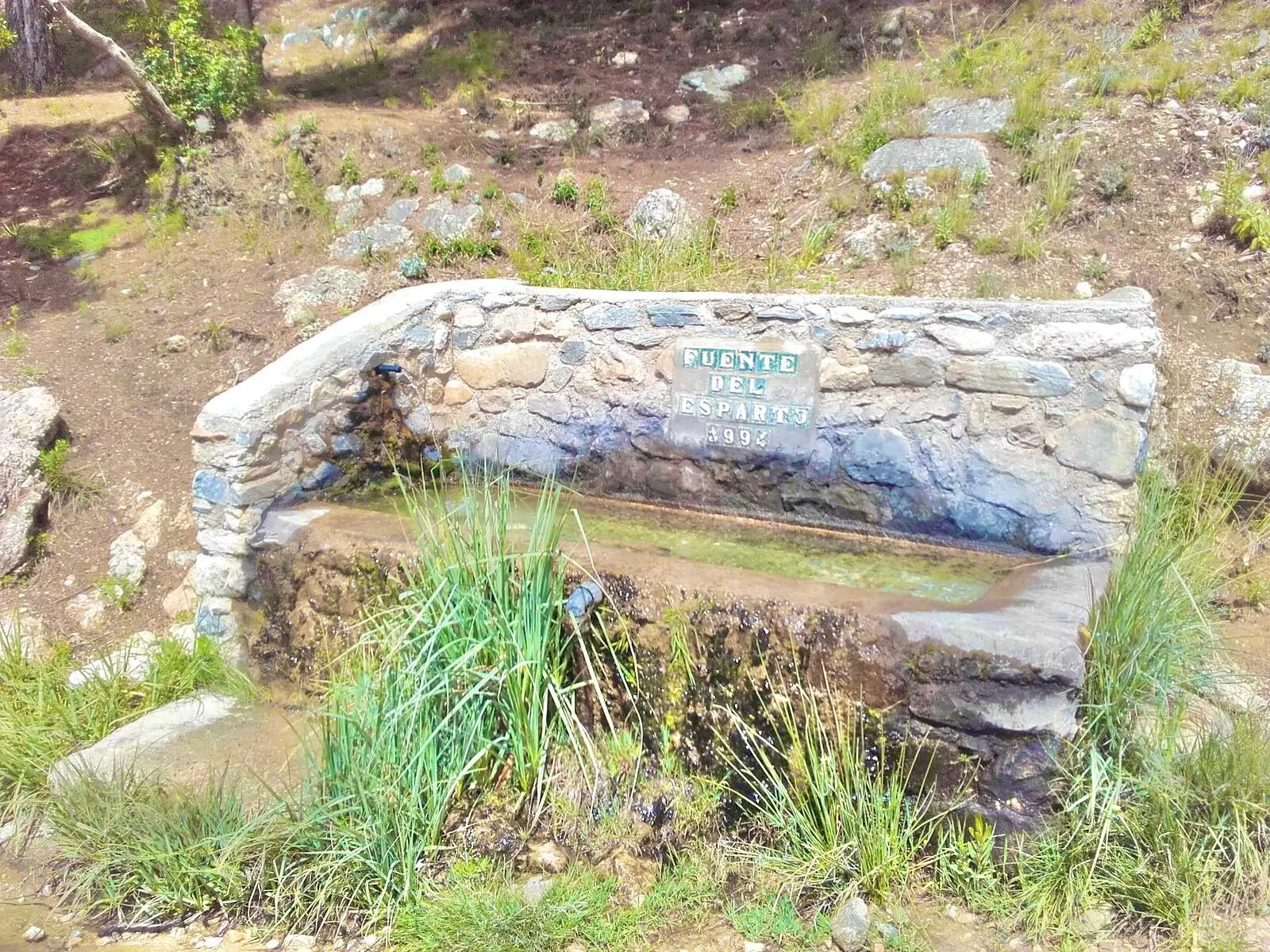
Fuente del Esparto
Start and last water.
Photo: EsNerja

Pico del Cielo
A cross at 1,508 m, halfway along.
Photo: Juan Pablo Olmo, CC BY 2.0, via Wikimedia Commons

The Almijara ridge
White dolomite rock and sand between El Cielo and Navachica.
Photo: Juan Pablo Olmo, CC BY 2.0, via Wikimedia Commons
Navachica trig point
1,832 m, the top of the Sierra de Almijara.
Photo: EsNerja
Frequently asked questions
Keep exploring
Distance
21.0 km
Time
9h 30min
Elevation +
1900 m
Elevation −
1900 m
Max alt.
1832 m
Min alt.
551 m